Landslide Hunter
Published in NWO-funded; Open Universiteit and University of Twente, 2024
A fully automated Earth-observation platform for rapid landslide detection and mapping (2024–2025), extending time-series and index-based heuristics to optical satellite imagery to map landslides even in semi-cloudy conditions. Built during a postdoctoral position at Open Universiteit and University of Twente. Total budget €80,000 over 1 year.
Has produced 3 conference papers: 2 EGU General Assembly abstracts and 1 peer-reviewed paper (Living Planet Symposium 2025). See Publications.
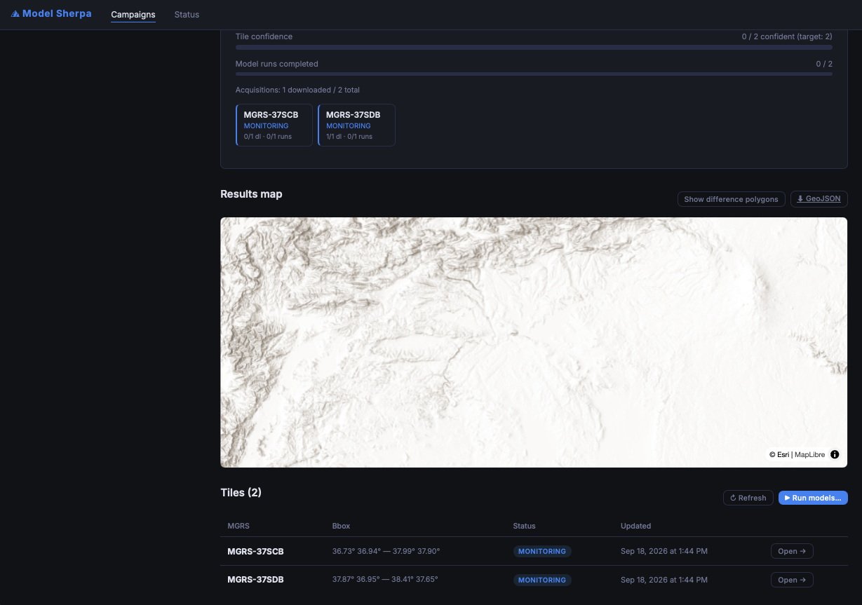
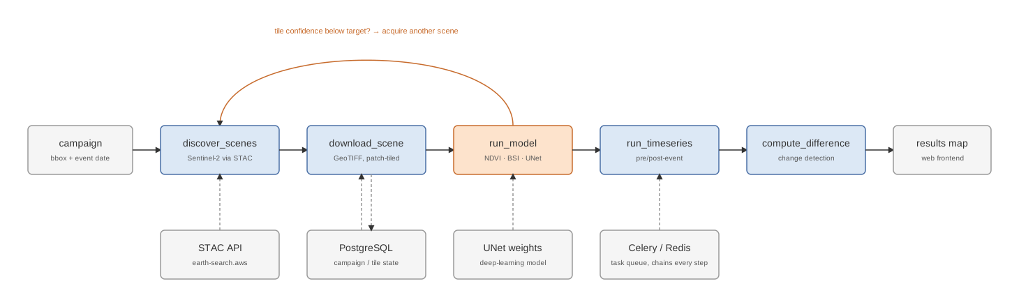
Technology: Python campaign-orchestration platform (FastAPI, Celery/Redis, PostgreSQL) discovering Sentinel-2 scenes via STAC, patch-based tiling of GeoTIFF imagery for inference across traditional (NDVI, BSI) and deep-learning (UNet) models, with iterative acquisition governed by per-tile confidence-based stopping criteria and pre/post-event time-series change detection.
My role: Implemented the core functionalities: model inference (traditional and deep-learning) and iterative mosaicking with uncertainty-based stopping criteria.